Wednesday, August 31, 2011

Experience late summer wildflower display Sept. 3 at Prairie State Park

Prairie grassesImage via Wikipedia
 JEFFERSON CITYMO., AUG. 29, 2011 - As the tallgrass prairie transitions from summer to fall, it is ablaze with color.  On Sept. 3, experience this color explosion on a wildflower walk at Prairie State Park near Mindenmines. The 1.6-mile walk begins at 10 a.m. at the park's nature center and will last approximately two hours.   
            The park naturalist will lead the hike as you walk among the tall grasses and colorful fall flowers to learn more about the prairie ecosystem.  Dress for the weather and hiking across the prairie; long pants, sturdy shoes and insect repellent are recommended.
             Prairie State Park is located at 128 NW 150th Lane in Barton County. For more details, call PrairieState Park at 417-843-6711 or the Department of Natural Resources toll free at 800-334-6946 (voice) or800-379-2419 (Telecommunications Device for the Deaf). For more information on Missouri state parks, visitmostateparks.com.

Enhanced by Zemanta

Tuesday, August 30, 2011

Big Oak Tree State Park and Towosahgy State Historic Site reopen to the public

A photo from the Towosahgy State Historic Site...Image via Wikipedia
JEFFERSON CITYMO., AUG. 30, 2011 -- In May, Big Oak Tree State Park and Towosahgy State Historic Site in Mississippi County were covered with 12 to 16 feet of water and sand following the intentional breach of the Birds Point Levee along the Mississippi River. On Sept. 2, these important natural and cultural resources in the Missouri state park system will reopen to the public. Two events in September will provide special opportunities to revisit these areas. 
            "Our staff monitored these two facilities throughout the summer to determine the impact of the breach. We are pleased to be able to reopen these areas to the public while we continue to make repairs to our facilities," said Bill Bryan, director of Missouri State Parks, a division of the Missouri Department of Natural Resources.
            At Big Oak Tree State Park, the areas open for visitor use include the main picnic area and the boardwalk, which takes visitors into the heart of the vast swamp forest. Other portions of the park remain closed while assessment continues on the impact from the flooding. All of Towosahgy State Historic Site will reopen to the public.
            Visitors will have a chance to celebrate the reopening of Big Oak Tree State Park during its annual Living History Day event Sept. 10. This free event will take place from 10 a.m. to 4 p.m. in the park's main day-use area. The event will feature demonstrations of old-time skills such as spinning, trapping, flintknapping and making canvas floor cloths. "Bluegrass Revival" and the "Shoestring Band" will provide music throughout the day and barbecue and funnel cakes will be available for purchase. The Southeast Explorer, a mobile teaching and learning center fromSoutheast Missouri State University, will be available with exhibits about the history of southeastMissouri. The center features activities for grades three through six so the event will provide something for the entire family and all age groups.
            On Sept. 24, the rural location of Towosahgy State Historic Site will provide the perfect setting for an evening event showcasing the night sky. The site preserves the remains of a once-fortified Indian village of the Mississippian Culture between 1000 A.D. and 1400 A.D.  Join staff on top of the temple mound to view the blanket of stars from the same vantage point as Native Americans did more than 1,000 years ago. The event will include Native American stories of the night and tales of the constellations. This free event will be from 7 p.m. to 9 p.m.
            "Visitors at these two sites will notice some changes and areas that will need improvements. We can continue to make these improvements while our visitors take advantage of the great fall weather to revisit two outstanding resources in southeast Missouri," Bryan said
            Big Oak Tree State Park is located 15 miles south of East Prairie on Highway 102. Towosahgy State Historic Site is located approximately 15 miles southeast of East Prairie on County Road 502. To reach the site, take State Highway 77 south toward Dorena and turn west on County Road 502. For more information on these events, call Hunter-Dawson State Historic Site at573-748-5340. For more information about Missouri state parks and historic sites, call the Missouri Department of Natural Resources toll free at 800-334-6946 (voice) or 800-379-2419(Telecommunications Device for the Deaf) or visit mostateparks.com.

Enhanced by Zemanta

Investigation Underway Into Loss of Water at Noblett Lake

Mark Twain National ForestImage via Wikipedia
AVA, Missouri – Mark Twain National Forest law enforcement investigators are looking into the discovery August 17, 2011 of loss of water at Noblett Lake, located south of Willow Springs, Missouri.
Mark Twain National Forest Ava/Cassville/Willow Springs District Ranger Jenny Farenbaugh said the lake flow gate will remain open so fish can survive and move down stream to Spring Creek, which flows into North Fork River, while Forest officials consult with Missouri Department of Conservation and Missouri Department of Natural Resources.
Noblett Lake is temporarily closed to the public. Noblett Recreation Area remains open.
If someone has information about the incident, please contact 417-683-4428 ext. 199.
Since there is an ongoing law enforcement investigation, no further details will be released until the investigation is completed.
Mark Twain National Forest is the largest public land manager in Missouri with 1.5 million acres in 29 counties in southern and central Missouri. Mark Twain National Forest’s mission is to continue to restore Missouri’s great outdoors and maintain a healthy, working forest.

Enhanced by Zemanta

Monday, August 29, 2011

TREE STAND SAFETY

Kong - firebrigadeImage via Wikipedia
By Tim McDaniel, Conservation Agent
Hunting is a much safer sport than most people realize. More people
are killed playing team sports such as football each year than in
firearms-related hunting accidents. There is, however, another type
of hunting accident to think about. Falls from tree stands account
for more injuries than any other type of recorded hunting accident.
A university study done a few years ago found that one third of all
hunters who hunt from tree stands will fall at some time. Injuries from
these falls can range from bruises to broken bones and even death.
To decrease your chances of an injury please follow some simple
rules for tree stand safety.
1. Always wear a safety harness. The newer full body harnesses
with fall arrest systems have proven to be the most effective. Most
important is to set the length of your tether so that if you do fall you
will not go below the level of the stand.
2. Remember that most falls occur when climbing into or out of the
stand. Wear a climbing harness and use extra caution during these times.
3. Check your stands. Many people think that permanent stands are safer because they are usually
larger and nailed to the tree. Remember though that as the tree grows nails can be forced loose and
animals will sometimes chew on the wood. Check all stands before season and replace any chewed or
rotted boards. Refasten any loose boards. With hang on stands check the
bolts to be sure that the nuts have not loosened. Make sure that straps are
secure and not rotted and that buckles have not rusted. Replace straps on
a regular schedule. I have found that few straps last more than two years.
4. Use a pull rope. Never climb into a stand while carrying a bow or gun.
Climb into the stand, attach your safety harness, and then use a pull rope
to bring up your unloaded bow or gun.
5. Take your time when you hang stands. Mistakes happen when you
rush. A loose strap or unlocked buckle can end your hunt in an instant.
6. Carry a cell phone with you in a buttoned pocket so it will be accessible
if you fall and need to call for help.
7. Leave a record. If you do fall, your injuries may prevent you from
walking out. Let someone know where you will be and when you will 
return. This could prevent you from spending a cold night lying on the


Enhanced by Zemanta

Sunday, August 28, 2011

Learn to enjoy the outdoors at WOW Kansas City Sept. 23-24


 JEFFERSON CITYMo., Aug. 25, 2011 – Have you ever wanted to learn skills that will enhance your outdoor adventures?  If you answered yes, then WOW Kansas City is for you.  WOW Kansas City will be held in Swope ParkSept. 23-24 and registration is open now.
            The WOW National Outdoor Recreation and Conservation School is packed with opportunities for people of all ages to learn outdoor recreation skills. The event is sponsored by the Missouri Department of Natural Resources; Kansas City, Missouri, Parks and Recreation; Bass Pro Shops; U.S. Army Corps of Engineers; U.S. Forest Service, U.S. Fish and Wildlife Service, Missouri Department of Conservation; Wonders of Wildlife; the National Park Service and Missouri State University.  The event will begin on Friday evening with a camping opportunity, and will continue from 6:30 a.m. to 3 p.m. on Saturday.
            WOW Kansas City is designed to teach participants how to enjoy a wide range of outdoor recreation activities while practicing personal safety and outdoor responsibility. WOW will offer classes in a variety of outdoor skills including archery, fishing, canoeing, campfire cooking, camping and more. Participants will camp at SwopePark and participate in Saturday classes at James A. Reed Memorial Wildlife Area. Transportation to the wildlife area will be provided from Swope Park.
            Classes are open to anyone age nine or above; however, nine to 12 year olds must be accompanied by a parent or guardian to classes. The trained professionals provide hands-on instruction for people who may not be familiar with the outdoors and children who may be experiencing nature for the first time. The workshop is a great opportunity for families to learn activities together and take the "Children in Nature Challenge." 
            The cost to attend is $15 per person or $30 per family, making it an affordable day of family fun. Financial assistance is also available.  Advance registration is required and the deadline to register is Sept. 9.
            Camping on Friday night will be held at Camp Lake of the Woods in Swope Park and will begin at 4 p.m. with tent setup and a hands-on outdoor cooking experience (food is provided).  Evening activities will include an owl program and family activities and hikes.  Tents will be available to those who do not have one and can be reserved through the registration process.
            For more information or to request a registration packet, contact the Missouri Department of Natural Resources by calling toll free 800-334-6946 (voice) or 800-379-2419 (Telecommunications Device for the Deaf) or sending an email to moparks@dnr.mo.gov.  Registration information and forms are also available on the web atmostateparks.com/wow.

Enhanced by Zemanta

Saturday, August 27, 2011

USFWS Fish Passage Program works with Midwest partners to solve barrier problems

Logo of the United States Fish and Wildlife Se...Image via Wikipedia
The U.S. Fish and Wildlife Service awarded more than $1.5 million in 2011 through the National Fish Passage Program to support projects in Iowa, Illinois, Michigan, Minnesota, Wisconsin, Ohio and Missouri.  Funding will support the removal of 20 fish passage barriers, reconnecting more than 545 stream miles, as well as survey and monitoring activities.  These projects are supported by an additional $3.2 million in matching, non-federal funds.

Construction of millions of culverts, dams, dikes, water diversions, and other artificial barriers impound and redirect water for flood control, drinking water, electricity, irrigation, and transportation -- all changing the natural features of rivers and streams.  Balancing the importance of stream connectivity for local fish species with the construction of these structures is a conservation challenge.

Through the National Fish Passage Program, the Service and its partners have begun to reverse the harmful impacts of artificial barriers to native fish species and the aquatic environment.  The Fish Passage Program uses a voluntary, non-regulatory approach to work with municipal, state, tribal and federal agencies, as well as non-governmental agencies to reopen and improve aquatic habitats in streams and rivers.  The program provides funding and technical expertise to partners to remove or bypass dams and other obstructions and replace or improve culverts under roads or railroad tracks -- all to allow fish to swim through.

2011 Fish Passage Program project examples in the Midwest include:
Michigan - $232,049.10 on-the-ground federal funds and $1,685,000 in partner contributions to completely remove Brown Bridge Dam in Grand Traverse County and restore the stream channel and associated riparian corridor and wetlands. Funding from the Fish Passage program will be combined with other funding to complete the entire removal, restoration and monitoring process and reconnect 145 stream miles.

Minnesota - $100,000 on-the-ground federal funds and $160,000 in partner contributions to remove Montevideo Dam on the Chippewa River in Chippewa County, which will reconnect 18 stream miles.

Missouri - $85,000 on-the-ground federal funds and $115,000 in partner contributions to replace a low water crossing over the Little Niangua River to benefit threatened Niangua darter in Dallas County, which will reconnect 6.1 stream miles.

Illinois - $11,760 on-the-ground federal funds and $11,760 in partner contributions to fund the
planning, permitting, and removal of the Konopasek Dam on the North Branch Kishwaukee River in McHenry County, which will reconnect 20.7 stream miles.

Iowa - $42,000 on-the-ground federal funds and $43,000 in partner contributions to replace three perched culvert structures on Buck Creek in Hamilton County, which will reconnect 13.5 stream miles.

Ohio - $30,000 on-the-ground federal funds and $67,240 in partner contributions to replace a multi-celled culvert system on Archers Fork, a major tributary to the Little
Muskingum River in Washington County, with box culverts, which will allow fish passage under most stream flows. The project is intended to enhance the biological health of both Archers Fork and the Little Muskingum River watershed and reconnect 9.25 stream miles.

Wisconsin - $45,000 on-the-ground federal and $45,000 in partner contributions to replace an existing culvert on the Middle Inlet stream in Marinette County with an aluminized “floorless” plate arch with sufficient geometry to match base channel flow and minimize stream velocities associated with the existing culvert.  This will reconnect over 14 stream miles.

In many cases, these funds go directly to on-the-ground replacement of deteriorating structures, which helps to improve local infrastructure while supporting local economies and reconnecting fish habitat at the same time.

Since its inception in 1999, the National Fish Passage Program has removed or bypassed 950 barriers, restoring access to almost 15,500 miles of river and 82,100 acres of wetlands.  The Program has also been able to leverage an average of three dollars for every project dollar spent through its partners.
Enhanced by Zemanta

Friday, August 26, 2011

Foundation seeks contributions to upgrade trout park


Courtesy Missouri Department of Conservation
LEBANON, Mo. – If you have ever wished it was easier to get to the water at Bennett Spring State Park, the Missouri Conservation Heritage Foundation (MCHF) has a way to turn your wish into a reality.

One of the most popular places to fish at the park is just upstream from the stone bridge adjacent to one of the hatchery buildings operated by the Missouri Department of Conservation (MDC). This site also offers a stunning view of the park’s iconic dam and waterfall. Years ago, this bank was covered with a rough concrete slurry to prevent erosion. That was an inexpensive solution to the erosion problem, but it is unattractive and difficult to negotiate on foot.

MCHF, a nonprofit citizen’s group set up to support conservation- and recreation-related projects, wants to replace the makeshift bank covering with a permanent, concrete walkway and viewing platform. As envisioned, the platform would be 72 feet long and 5 feet wide. MCHF is trying to raise $45,000 to fund the project.

“The current situation is inconvenient and deteriorating,” said MCHF Executive Director Rick Thom. “Fixing it makes sense for a lot of reasons. Unfortunately, money for improvements at state parks is very scarce right now, even for projects with price tags as modest as this one. We looked at this situation and decided it was a case where the people who love and use the park can accomplish for themselves what government can’t do.”

Thom noted that as many as 180,000 anglers visit Bennett Spring annually. An average contribution of $10 from just 2.5 percent of those anglers would be enough to fund the work. MCHF hopes to raise the money in time to build the platform before the trout-fishing season opener on March 1, 2012.

MCHF is accepting contributions at www.mochf.org, or by sending contributions to MCHF, PO Box 366, Jefferson City, MO 65102-0366. Donations should be marked “Bennett Spring Platform.” Donors at $1,000 and above will receive a framed print of the 1995 Missouri Trout Stamp signed and numbered by wildlife artist Chuck Witcher. The print features a beautiful brown trout. The trout stamp of the same number is also mounted with the print. A permanent plaque at the structure will recognize donors at two levels, $1,000  and $5,000 and above.

-Jim Low-

Enhanced by Zemanta

Informational meeting planned Aug. 27 at Pershing State Park

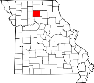
Map of Missouri highlighting Linn CountyImage via Wikipedia
JEFFERSON CITYMo., Aug. 25, 2011 -- The public is invited to bring their ideas to an informational meeting on Saturday, Aug. 27, at Pershing State Park near Laclede.  The informational meeting will begin at 7 p.m. in the amphitheater at the campground 
Accomplishments at the park and future plans will be highlighted during the informational meeting. Visitors are invited to share comments on the park’s services and operations. 
This informational meeting is part of an ongoing effort to ensure citizens have input on facilities and services offered in state parks and historic sites.
Pershing State Park is located 18 miles east of Chillicothe or seven miles west ofBrookfield on Highway 36 in Linn County. The park’s campground is located approximately one mile south of Highway 36 on Missouri Route 130.
People requiring special services or accommodations to attend the meeting can make arrangements by calling the park office at 660-963-2299 or by calling the Missouri Department of Natural Resources toll free at 800-334-6946 (voice) or 800-379-2419 (Telecommunications Device for the Deaf). For information about state parks and historic sites, visit mostateparks.com.

Enhanced by Zemanta

8/26/2011 MDC Fishing Report

Largemouth bass, caught and released in MinnesotaImage via WikipediaPLEASE CHECK REGULATIONS CAREFULLY: Special regulations may apply to designated portions of water bodies; some baits and lures may not be legal for all portions.


CENTRAL REGION (573) 882-8388

    LAKES

Binder: 88 degrees, normal, clear; channel catfish good on liver and nightcrawlers; bluegill fair on crickets and worms; largemouth bass fair on plastic worms and spinnerbaits; all other species slow.


 (Report made on 8/25/2011)

Blind Pony Lake: 79 degrees, dingy; 2' low; all species slow; the lake is closed to private boats, and bait held or transported in containers with water is prohibited. (Report made on 8/24/2011)

Lake of the Ozarks (Bagnell Tailwater): 77 degrees, normal, dingy; black bass slow, try crankbaits or worms; white bass slow, try light colored soft plastics and crappie jigs; crappie slow, try minnows and crappie jigs; catfish fair using worms, cut shad and chicken livers.

 (Report made on 8/24/2011)

Lake of the Ozarks (Glaize): 82 degrees, dingy; black bass slow, try dark colored soft plastics and buzzbaits; white bass slow, try light colored soft plastics and Rooster Tails;
crappie slow, try minnows and crappie jigs; catfish fair on stinkbaits and cut baits.
 (Report made on 8/24/2011)

Lake of the Ozarks (Gravois): 82 degrees, dingy; all species slow.
 (Report made on 8/24/2011)

Lake of the Ozarks (Niangua): 82 degrees, dingy; crappie good on minnows and jigs; catfish good on live bait, chicken livers and cut shad; black bass slow, try plastic worms; white bass slow, try spinnerbaits.


 (Report made on 8/24/2011)

Lake of the Ozarks (Osage): 82 degrees, dingy; crappie good on minnows and jigs; catfish good on live bait, chicken livers and cut shad; black bass slow, try plastic worms; white bass slow, try spinnerbaits.
 (Report made on 8/24/2011)

Little Dixie: 89 degrees, the water level is down about 3' so it may be hard to get a boat launched off the boat ramp; catfish fair on liver and minnows; largemouth bass fair on plastic worms; all other species slow. (Report made on 8/24/2011)

    RIVERS

Lamine: high, muddy; channel catfish good on worms in early evening until dark at Roberts Bluff Access; blue catfish and flathead catfish fair on setlines baited with goldfish downstream from DeBourgmont Access; all other species slow. (Report made on 8/25/2011)

Missouri (Middle): high, muddy; all species good on live baits. (Report made on 8/24/2011)

Osage (lower, at Tuscumbia): 78 degrees, normal, dingy; black bass slow, try crankbaits or worms; white bass slow, try light colored soft plastics and crappie jigs; crappie slow, try minnows and crappie jigs; catfish fair using worms, cut shad and chicken livers.
 (Report made on 8/24/2011)

----------------------
KANSAS CITY REGION (816) 655-6254

    LAKES

James A. Reed Area: 83 degrees, clear; water level 1' low; largemouth bass and crappie fair; all other species slow. (Report made on 8/24/2011)

Montrose: 87 degrees, low, dingy; catfish fair; all other species slow; fishing pressure light. (Report made on 8/25/2011)

Schell-Osage (Atkinson Lake): 88 degrees, low, clear; all species fair; fishing pressure light. (Report made on 8/25/2011)

Schell-Osage (Schell Lake): 89 degrees, low, clear; all species fair; fishing pressure light. (Report made on 8/25/2011)

Truman: 85 degrees, normal, clear; crappie good using jigs and minnows in 10' of water; catfish good using cut bait or shad; white bass and hybrid bass good using shad and jigs on flats.  (Report made on 8/25/2011)

Truman Tailwaters: 85 degrees, low, dingy; all species slow; fishing pressure light. (Report made on 8/25/2011)

    RIVERS

Missouri River: the river is flooded; all species slow. (Report made on 8/24/2011)

----------------------
NORTHEAST REGION (660) 785-2420

    LAKES

Hunnewell: 80 degrees, low, clear; largemouth bass good on crankbaits; channel catfish fair on chicken liver; bluegill fair on Beetle Spins; all other species slow. (Report made on 8/24/2011)

Long Branch: 81 degrees, low, clear; channel catfish fair on setlines using live bait; crappie fair on jigs; flathead catfish fair on cut bait; all other species slow.  (Report made on 8/24/2011)

Mark Twain: 83 degrees, normal, dingy; crappie fair on minnows and assorted jigs; channel catfish fair on cut bait; all other species slow. (Report made on 8/24/2011)

Sever: 84 degrees, normal, dingy; channel catfish fair on cut bait; black bass fair on crankbaits around riprap; crappie fair on minnows; all other species slow. (Report made on 8/24/2011)

Thomas Hill: 85 degrees, normal, dingy; crappie fair along the Hwy. T rock in the 9"-10" size range using jigs and minnows; channel catfish good using setlines on live bait; all other species slow. (Report made on 8/25/2011)

    RIVERS

Mississippi (above St. Louis): 82 degrees, falling, dingy; flathead catfish good on live bluegill; channel catfish good on stinkbaits; blue catfish good on cut bait; all other species slow. (Report made on 8/24/2011)

Salt (below Mark Twain): 76 degrees, normal, muddy; channel catfish good on prepared baits; drum good on nightcrawlers; white bass fair on spinnerbaits; all other species slow. (Report made on 8/24/2011)

----------------------
NORTHWEST REGION (816) 271-3100

    LAKES

Bilby Ranch Lake: 78 degrees, normal, clear; black bass good on crankbaits and buzzbaits; channel catfish good on liver; all other species fair. (Report made on 8/24/2011)

Mozingo: 79 degrees, normal, clear; black bass good on weedlines with plastics; crappie good on jigs in standing timber; all other species slow. (Report made on 8/24/2011)

Paho: 84 degrees, normal, full pool; channel catfish fair on commercial bait; all other species slow.

 (Report made on 8/24/2011)

Pony Express: 82 degrees, normal, dingy; catfish fair; all other species slow. (Report made on 8/23/2011)

Smithville: 82 degrees, falling, dingy; crappie fair in 7'-11' of water near brush/trees; black bass slow; catfish fair on shad and prepared baits; white bass fair; walleye slow.  (Report made on 8/25/2011)

    RIVERS

Grand: 74 degrees, rising, clear; channel catfish and blue catfish good; flathead catfish fair; all other species good. (Report made on 8/24/2011)

Missouri (below Iowa line): 83 degrees, high, dingy; all species slow. (Report made on 8/24/2011)

----------------------
OZARK REGION (417) 255-9561

    LAKES

Bull Shoals (East): 86 degrees, high, dingy; all species slow. (Report made on 8/24/2011)

Norfork: 85 degrees, high, dingy; all species slow. (Report made on 8/24/2011)

    RIVERS

Big Piney (lower, Pulaski Co.): 83 degrees, rising, dingy; smallmouth bass and goggle-eye fair on crankbaits and soft plastic baits; channel catfish slow on live bait. (Report made on 8/24/2011)

Big Piney (Upper): 77 degrees, normal, dingy; black bass and goggle-eye fair on soft plastics. (Report made on 8/24/2011)

Bryant Creek: 82 degrees, normal, dingy; smallmouth bass fair on soft plastic baits. (Report made on 8/24/2011)

Current: 77 degrees, normal, clear; all species good on plastic worms. (Report made on 8/24/2011)

Eleven Point: 62 degrees, normal, clear; all species slow. (Report made on 8/24/2011)

Gasconade (middle, Pulaski Co.): 84 degrees, rising, dingy; smallmouth bass and goggle-eye fair on soft plastic baits and crankbaits. (Report made on 8/24/2011)

Gasconade (upper): 83 degrees, normal, dingy; all species slow. (Report made on 8/24/2011)

Jacks Fork: 76 degrees, normal, clear; smallmouth bass and goggle-eye good on soft plastics and Beetle Spins. (Report made on 8/24/2011)

North Fork: 68 degrees, normal, clear; smallmouth bass and goggle-eye fair on soft plastics. (Report made on 8/24/2011)

----------------------
SOUTHEAST REGION (573) 290-5858

    LAKES

Clearwater Lake: 81 degrees, normal, clear; crappie good while trolling with crankbaits; largemouth bass fair on plastic or topwater baits; bluegill fair on worms or crickets; all other species slow. (Report made on 8/24/2011)

Council Bluff: 81 degrees, normal, clear; largemouth bass fair on dark colored soft plastics and topwater lures during low light periods; bluegill and redear sunfish fair on worms and crickets; all other species slow. (Report made on 8/25/2011)

Cypress Lake: 87 degrees, normal, dingy; channel catfish good in 2'-3' depths using worms and stinkbait; crappie slow using minnows and jigs in 3' depths; bluegill and redear sunfish fair in 2'-3' depths using crickets, small jigs, and small pieces of worms; largemouth bass fair on spinnerbaits, jigs, and plastic worms in 3' depths or greater. (Report made on 8/24/2011)

Duck Creek: 79 degrees, normal, clear; largemouth bass good on topwater lures; bluegill, redear sunfish and warmouth sunfish good on crickets and jigs; all other species slow. (Report made on 8/25/2011)

Lake Girardeau: normal, clear; channel catfish fair on worms; all other species slow. (Report made on 8/24/2011)

Perry County Lake: 87 degrees, clear; channel catfish fair on liver; black bass fair on topwater lures; all other species slow. (Report made on 8/24/2011)

Robert DeLaney Lake: 85 degrees, normal, channel catfish fair on worms, liver, and stinkbait; all other species slow. (Report made on 8/24/2011)

Wappapello: normal, black bass good on spinnerbaits and plastic worms early and late in the day; bluegill fair on crickets and worms along shoreline; crappie fair on minnows and jigs in the lake in the river channel; channel catfish fair on trotlines and jug lines at night using live bait. Anglers should note the 9" minimum length regulation for crappie on Wappapello Lake. All areas around the lake are now open since the lake water level has dropped.  Call the Wappapello Lake Recreation Hotline for updates at 573-222-8139. (Report made on 8/24/2011)

    RIVERS

Black River (near Annapolis): 77 degrees, low, clear; all species slow. (Report made on 8/24/2011)

Castor River (above Zalma): low, clear; all species good. (Report made on 8/24/2011)

Lower Black River (Clearwater Dam): normal, dingy; black bass fair on topwater lures; channel catfish fair on live bait; crappie fair on minnows and jigs; walleye fair on crankbaits below the basin; all other species slow.
There have been some instances of paddlefish being caught and hooked in the mouth while using traditional fishing methods as of late.  Paddlefish are closed to taking by any method in the Black River except from March 15 through April 30.  If a paddlefish is caught outside of those specified dates it must be released immediately. (Report made on 8/24/2011)

Mississippi (below Charleston): low, dingy; channel catfish fair on liver, worms and live frogs; all other species slow. (Report made on 8/24/2011)

Mississippi River (Cape Girardeau): 79 degrees, falling, muddy; all species slow. (Report made on 8/24/2011)

St. Francis (above Wappapello): low, clear; black bass good on large minnows; all other species slow. (Report made on 8/24/2011)

St. Francis (below Wappapello): 83 degrees, low, dingy; channel catfish good on chicken liver and stinkbait; flathead catfish good on goldfish and small green sunfish; all other species slow. (Report made on 8/25/2011)

----------------------
SOUTHWEST REGION (417) 895-6881

    LAKES

Bull Shoals (West): 85 degrees, high, clear; Dam/Swan Creek area: walleye fair on nightcrawlers and jerkbaits; black bass fair on nightcrawlers and soft plastic baits; Beaver Creek area: catfish fair on nightcrawlers; black bass fair on jigs, soft plastics and nightcrawlers; all other species slow. (Report made on 8/25/2011)

Lake Taneycomo: 58 degrees, normal, clear; trout good on crankbaits and Little Cleos while trolling in 15' - 20' of water; Rogues and marabou jigs are working well when the dam is generating. (Report made on 8/24/2011)

Pomme de Terre: 83 degrees, low, clear; crappie good on minnows and jigs in 15' of water around structure; largemouth bass slow, best on plastic baits in 15' of water around structure and near points; all other species slow. (Report made on 8/23/2011)

Stockton: 85 degrees, low, clear; crappie good on minnows in 15' - 20' of water over brush piles; catfish good while drifting over flats in 15' - 20' of water; black bass good in 15' - 20' of water over brush piles; white bass good on Rooster Tails and small spinners over flats and around points; walleye good on nightcrawlers while trolling or drift fishing in 20' of water; all other species slow. (Report made on 8/25/2011)

Table Rock (James River arm): 83 degrees, normal, clear; black bass fair while dragging soft plastic crayfish around points; live nightcrawlers and live crayfish are working well in 25' or more of water; all other species slow. (Report made on 8/24/2011)

Table Rock (main lake): 83 degrees, normal, dingy; black bass fair while dragging soft plastic crayfish around points; live nightcrawlers and live crayfish are working well in 25' or more of water; all other species slow. (Report made on 8/24/2011)

    RIVERS

Big Niangua: 75 degrees, normal, clear; trout good on natural baits and Power Baits below Bennett Spring; black bass fair on soft plastics; goggle-eye fair, best on soft plastics and jigs; all other species slow. (Report made on 8/23/2011)

James River (lower): 84 degrees, low, clear; goggle-eye good on minnows and spinners around rootwads and rocky structure; black bass fair on crankbaits off of points and Texas rigged with live worms and dark colored soft plastic worms in the evening; crappie fair on green jigs and minnows over brush piles; catfish fair on cut baits and nightcrawlers; best at night on trotlines and limb lines. (Report made on 8/24/2011)

----------------------
ST. LOUIS REGION (636) 300-1953

    LAKES

Busch Memorial Conservation Area Lake 33: 84 degrees, normal, dingy; bluegill fair on worms; black bass fair on plastic worms; channel catfish slow on blood baits; please remove your litter.  (Report made on 8/25/2011)

Busch Memorial Conservation Area Lakes 3, 4, 5, 7, and 23: 82 degrees, normal, dingy; channel catfish slow on blood baits; limit 4; please remove litter.


 (Report made on 8/25/2011)

    RIVERS

Big River: 81 degrees, normal, dingy; channel catfish fair on cut bait and worms; black bass fair on minnows; crappie slow on minnows; bluegill good on crickets; all other species slow. (Report made on 8/25/2011)

Bourbeuse (middle, lower, Franklin Co.): 81 degrees, normal, clear; channel catfish fair on cut bait, blood bait and worms; bluegill good on worms; black bass fair on plastic worms; all other species fair on natural baits.
 (Report made on 8/25/2011)

Meramec (above Sullivan, Crawford Co.): 82 degrees, normal, dingy; black bass fair on topwater lures and plastic worms; channel catfish fair on minnows and worms; bluegill and sunfish fair on natural baits; all other species slow. (Report made on 8/25/2011)

Meramec (below Eureka): 82 degrees, normal, dingy; channel catfish slow on natural baits; black bass slow on plastic worms; carp fair on doughbaits; bluegill, drum and sunfish fair on worms; all other species slow. (Report made on 8/25/2011)

Missouri (below New Haven): 81 degrees, high, muddy; channel catfish slow on worms and prepared baits; all other species slow. (Report made on 8/25/2011)

----------------------
TROUT PARKS

Bennett Spring State Park: 56 degrees, clear; the spring level is near normal; Zone 1 and 2 best lures: red colored and red with green head colored brassies, John Deere colored mini jigs, ginger colored and brown colored bead head Cracklebacks, gingersnap with 8 oz. gold head colored, red and black colored, pink and white colored and salmon and brown colored  marabou jigs, green and black with a gold spinner and black colored with a silver spinner Rooster Tails, shrimp colored, chartreuse colored and red and white colored glo balls, red colored and olive colored brassies; Zone 3 best lures: salmon peach colored and yellow colored Power Baits, red and white colored worms, and salmon eggs.  August fishing hours are 7:00 a.m. to 8:00 p.m.  September fishing hours are 7:30 a.m. to  7:15 p.m. We will be cutting weeds September 13 and 14.  We will start around 8 a.m. and finish by 3 p.m.  Thank you for your patience. (Report made on 8/25/2011)

Maramec Spring Park: 58 degrees, fishing is excellent; the water is clear with good flow; dough and putty baits are producing good numbers when fished free floating or underneath a float; throughout the spring branch feather jigs in black/yellow, olive, white, and pink are producing good numbers of fish;  fish are holding in deep holes and below the falls, target these areas for best success; fishing hours for the month of August are 7:00 a.m. to 8:00 p.m.;  Ladies Free Fishing Day is Saturday, September 10th. (Report made on 8/24/2011)

Montauk State Park: 59 degrees, the river level is normal; the water is clear; fishing is good on most baits; scented dough and putty baits are working well, as are flies, Rooster Tails and jigs, black and yellow, white, and olive colors are working well. Fishing has been slow during the hotter parts of the day. The best fishing is during the morning and evening hours. August fishing hours are 7:00 a.m. to 8:00 p.m. September fishing hours are 7:30 a.m. to 7:15 p.m.


For up-to-date stream conditions check  http://waterdata.usgs.gov/nwis/uv?07064440 (Report made on 8/24/2011)

Roaring River State Park: 58 degrees, the water is clear and normal; fishing has been very good early in the day, late in the evening and in shady spots during the day; dry fly fishing is excellent right now; cheese yellow, white fluorescent, orange and brown colors in plastic eggs and worms working well; black, brown, olive and white spinners working well; small crankbaits are working well; marabou and micro jigs are good; olive, white, black/yellow and tan are good; in Zone 3: nightcrawlers, minnows and corn, white, orange or fluorescent yellow Power Bait paste is working well.
 (Report made on 8/24/2011)

Enhanced by Zemanta

Grand opening set Sept. 2 for new hiking and mountain biking trail at Table Rock State Park

Table Rock Dam that forms Table Rock Lake in B...Image via Wikipedia
JEFFERSON CITYMo., Aug24, 2011 -- Hikers and mountain bikers have a new reason to celebrate with the official grand opening of the first designated mountain biking trail system in the Branson area.  The White River Valley Trail in Table Rock State Park will be dedicated at 11 a.m. Friday, Sept. 2 at a trailhead near Branson.
            The White River Valley Trail, a 10.25 mile natural surface trail, is a joint land-use project between MissouriState Parks and the U.S. Army Corps of Engineers. The majority of the trail is within Table Rock State Park with the rest of it on USACE land.
            The ceremony will include representatives from Missouri State Parks, which administers Table Rock State Park, the USACE, local and state officials, and many of the volunteer groups that supported and helped build the trail.
            The trail was partially financed by two federal Recreational Trails Program grants. Because of the trail's outstanding use of the federal RTP grants, it was recognized in 2011 by the federal Coalition for Recreational Trails with the award in the Multi-Use Management and Corridor Sharing Category. Bill Bryan, director of Missouri State Parks, a division of the Missouri Department of Natural Resources, will present the award to the park during the ceremony.  
            "This trail will provide a great new recreational resource for mountain bikers and hikers and should bring users here from all over the area," said Bryan. "We are pleased to be a part of a trail that has been recognized nationally and has such amazing local support." 
             The trail, consisting of four loops with different characteristics, will provide a challenging experience for mountain bikers and hikers in a rugged and scenic area of the state. Trail users will experience elevation changes ranging from 710 feet to nearly 1,200 feet above sea levels with natural communities ranging from moist bottomland woodlands to dry dolomite glades on the higher areas. The trail will travel near old homesteads and relics of the Table Rock Dam construction during the 1950s with dramatic views of Table Rock Lake and Lake Taneycomo.
            Now that the trail has been completed, staff at Table Rock State Park plan to host adventure events and mountain biking races on the trail. The park also includes two other trails, a campground, picnic areas, and a full-service marina with access to Table Rock Lake    
            The main trailhead for the White River Valley Trail is located on Highway 165 north of the park's main entrance. For more information about Table Rock State Park, call the park directly at 417-334-4704 or the Missouri Department of Natural Resources toll free at 800-334-6946 (voice) or 800-379-2419 (Telecommunications Device for the Deaf). For information on Missouri state parks, go to mostateparks.com.

Enhanced by Zemanta

Thursday, August 25, 2011

First-time striper angler sets state record

The striped bass is the main piscivore of the LSZImage via Wikipedia
GAINESVILLE–“You’re not going to believe this until you try it.”

According to Bruce Cunningham, that is what his brothers said when trying to persuade him to go fishing with them in June. Brad and Brock Cunningham had discovered the excitement of catching striped bass at Bull Shoals Lake, and they wanted to share it with their older brother.

Bruce decided to play along, and at 1 a.m. June 18 he found himself holding a new state-record striper weighing in at 60 pounds, 9 ounces. The catch nudged aside the previous pole-and-line record, a 58-pounder caught by John West, of Republic, in July 2010.

Cunningham, 30, of Fordland, was fishing from a boat in the upper reaches of Bull Shoals when the record fish grabbed the large plastic minnow he was casting. He was fishing in about 40 feet of water.

The fish was 47 inches long and had a girth of slightly more than 36 inches.

The two younger Cunningham brothers were rewarded for sharing their discovery. They boated several other stripers that topped 40 pounds the night Bruce caught his.

Striped bass (Morone saxatilis) are native to the Atlantic Ocean but make spawning runs up rivers along the East Coast. These ocean-run striped bass can grow to 6 feet long and 125 pounds. Although not native to Missouri, “stripers” have adapted well to fresh-water reservoirs and streams. However, they do not grow as large in fresh water.

Bull Shoals is Missouri’s striped-bass mecca right now, thanks to a one-time stocking by the Arkansas Game and Fish Commission in 1998. That year, a mix-up resulted in the stocking of 19,000 striped bass. Ken Shirley, district fisheries supervisor for the Arkansas Game and Fish Commission, said the fish were intended for Norfork Lake.

“We were expecting a shipment of walleye for Bull Shoals,” said Shirley. “A summer helper called to tell us that a shipment of fish had arrived at the hatchery and asked where they were supposed to go. We thought it was the walleyes, so we told him to take them to Bull Shoals. It turned out they were striped bass.”
Shirley said the surviving fish from that mistaken stocking now weigh between 30 and 60 pounds and are near the end of their lives. He expects the boom in trophy striper fishing at Bull Shoals to taper off over the next four or five years as fish from the accidental stocking slowly disappear.

More information about Missouri fishing records is available at http://mdc.mo.gov/fishing/reports/records.
-Jim Low-

Enhanced by Zemanta

Wednesday, August 24, 2011

Beach at Watkins Woolen Mill State Park and State Historic Site reopens


 JEFFERSON CITYMo., Aug. 24, 2011 – The swimming beach at Watkins Woolen Mill State Parkand State Historic Site reopened today after water samples taken Monday were found to be well within the Missouri Department of Natural Resources’ water quality standards for state park beaches.
            With the exception of the beach at Lewis and Clark State Park, which is closed due to flooding, all ofMissouri’s state parks beaches are open to visitors.
            The water at all designated beaches in the state park system is sampled weekly during the recreational season by the Department of Natural Resources to determine suitability for swimming.
            Information about current status of beaches at other parks is available on the website atmostateparks.com. Signs indicating the status of the beaches are posted at the beaches as well.
            Other facilities at state parks may be unavailable to visitors. Missouri State Parks maintains a list of alerts and advisories at mostateparks.com.
            Missouri's state parks and historic sites offer something to suit everyone's taste - outdoor adventure, great scenery and a bit of history. With Missouri’s 85 state parks and historic sites, the possibilities are boundless.
            For more information about Missouri state parks and historic sites and swimming beaches, visitmostateparks.com.

Enhanced by Zemanta

Department emergency responders oversee fuel, fertilizer cleanup following crop duster crash in New Madrid County

Map of Missouri highlighting New Madrid CountyImage via Wikipedia
JEFFERSON CITYMO, AUG. 23, 2011 – The Missouri Department of Natural Resources is overseeing the cleanup of fuel and fertilizer following the Monday afternoon crash of a crop duster in NewMadrid County.

The department was notified early Monday evening by the Sikeston Fire Department that a crop duster had crashed upon take-off at a small airport located three miles south of Matthews in New Madrid County.

As a result of the accident, the plane came to rest in a waterway and began leaking both fuel and fertilizer. First responders to the scene used absorbent booms on the water to prevent the fuel from flowing beyond the accident site.

The department dispatched an emergency responder from its regional office in Poplar Bluff to oversee the cleanup of the waterway and to determine the extent of the environmental damage. Upon inspecting the site, the responder was able to determine that the release had resulted in a small fish kill and notified the Missouri Department of Conservation.

The Federal Aviation Administration is investigating the cause of the accident. The pilot of the plane reportedly was not injured. The plane is owned by Ag Air of Matthews.

The Environmental Emergency Response section is called to the scene of more than 300 emergencies each year, including fires, traffic accidents, leaking storage tanks and other incidents that could have a negative environmental impact. The department’s 24-hour spill line receives more than 1,600 incident reports annually.

To report an environmental emergency, including fuel spills, please contact the spill line at 573-634-2436. For more information contact the Missouri Department of Natural Resources at 800-361-4827 or 573-751-3443, or visit the department's website at dnr.mo.gov.

Enhanced by Zemanta

Saturday, August 20, 2011

Weekend promotes camping in Missouri state parks

Grand Gulf State Park in Missouri. The stream ...Image via Wikipedia
 JEFFERSON CITY, MO., AUG. 16, 2011 -- Summer is not over yet and a family camping trip to a Missouri state park is a great way to celebrate the season.

            On Aug. 26-28, anyone who camps two nights in any of 10 selected state park campgrounds will receive a coupon for a free night of camping on their next visit to any Missouri state park campground. The coupon can be redeemed for a campsite of the same type (basic, electric, electric-water or full-hookup) or may be upgraded for an additional fee. The promotional coupon is good for one year from the date of purchase.
 
             State parks participating in the promotion include Stockton State Park near Stockton; Pomme de Terre State Park near Hermitage; Harry S Truman State Park near Warsaw; Thousand Hills State Park near Kirksville; Wakonda State Park near La Grange; Mark Twain State Park near Stoutsville; Trail of Tears State Park near Jackson; Lake Wappapello State Park near Williamsville; Robertsville State Park near Robertsville; and Knob Noster State Park near Knob Noster.

            "There's plenty of time to make more camping memories with your family and friends. Camping in a Missouri state park campground is a great value and this special promotion offers an awesome opportunity to relax and enjoy the outdoors in state parks," said Bill Bryan, director of Missouri State Parks, a division of the Department of Natural Resources.

            Campgrounds at all 10 state parks offer both basic and electric campsites and a few also offer electric-water or full-hookup sites. Sites may be reserved in advance or obtained on a first-come, first-served basis.  The campgrounds offer modern showers and other conveniences and all parks offer other activities, such as water recreation, picnic sites and trails.

            For more information on Missouri state parks, call the Department of Natural Resources toll free at 800-334-6946 (voice) or 800-379-2419 (Telecommunications Device for the Deaf) or visit mostateparks.com.

Enhanced by Zemanta

Friday, August 19, 2011

Beach at Watkins Mill State Park closed due to bacteria levels


JEFFERSON CITY, MO, AUG. 17, 2011
The swimming beach at Watkins Woolen Mill State Park and Historic Site was closed today after water samples taken Monday showed bacteria levels in excess of the Department of Natural Resources’ standard for state park beaches.

The beach will remain closed until sample results indicate the bacteria levels are within the department’s standard for swimming beaches. All other facilities at the park, with the exception of Fox Hunt Picnic Area, are open and available to visitors.

The water at all designated beaches in the state park system is sampled weekly during the recreational season by the Missouri Department of Natural Resources to determine suitability for swimming. Water quality can be determined to be unsuitable for swimming based on either the single sample taken earlier in the week, or by the geometric mean, which is a mathematical value that takes into consideration results from the current week plus the results taken during the previous weeks.

The sample test results indicate a snap shot of the water quality taken at the beaches at a specific time; however, a single sample does not provide an overall sense of the water quality in the lake where the beach is located. Water samples are taken to check for E. coli, a common indicator species for bacteria.

Higher bacteria levels are often associated with heavy rains that result in runoff from adjacent lands. However, there are a number of possibilities that can contribute to higher bacteria, and chances are no single source is the cause.

Information about current status of beaches at other parks is available on the Missouri State Parks website at mostateparks.com. Signs indicating the status of the beaches are posted at the beaches as well.

Beaches and other facilities at state parks may be unavailable for reasons unrelated to bacteria. Lewis and Clark State Park, including its beach, is closed because of high water related to flooding on the Missouri River. Missouri State Parks maintains a list of alerts and advisories at mostateparks.com.

Missouri's state parks and historic sites offer something to suit everyone's taste - outdoor adventure, great scenery and a bit of history. With Missouri’s 85 state parks and historic sites, the possibilities are boundless.

For more information about Missouri state parks and historic sites and swimming beaches, visit mostateparks.com.

Enhanced by Zemanta

10 Tips to Keep Your Outdoor Gear in Working Order and Well Organized

Camping Gear - It's expensive to buy, make it last. Maintaining and organizing your outdoor gear is crucial for ensuring it remains func...