Showing posts with label missouri hiking. Show all posts

Tuesday, July 13, 2021

Missouri Outdoor Notes


Missouri anglers opinions are being solicited by the MDC. They'd love to have your input...or you could just complain later. (:-)  Follow this link... https://moconservation.co1.qualtrics.com/jfe/form/SV_74GYIpjY5YYyDsO?Q_DL=P9uh6Mi3EZlaMUE_74GYIpjY5YYyDsO_CGC_bQMktHSUvv3DPL0&Q_CHL=email.  It took me less than 3 minutes.

If you want to learn more about public hunting areas in the Springfield area, consider attending this event on Julky 20th...get more info by following this link... https://mdc-event-web.s3licensing.com/Event/EventDetails/178561

If you get confused bout snake species and want to learn more, this event is also in the Springfield area on July 16th. This one is virtual, so anyone can attend... Follow the link here... https://mdc-event-web.s3licensing.com/Event/EventDetails/178546

Still in the Springfield area, there's a wingshooting clinic at the Andy Dalton Range on July 17th...Dove season isn't that far down the road!  Here's where to get more info... https://mdc-event-web.s3licensing.com/Event/EventDetails/178560

By the way...the Fall Deer and Turkey Hunting books are out. You can get them at retailers where you get licenses or online here... https://mdc.mo.gov/about-us/about-regulations/fall-deer-turkey-hunting-regulations-information

Youth over on the East side of the state can get some good dove hunting at Columbia Bottoms for September 1st.  The link for more info is here... https://mdc.mo.gov/columbia-bottom-conservation-area-managed-dove-hunt-application

Another even over on the East side of Missouri is for people who want to develop food plots for wildlife. It'll be held August 3rd at Jay Henges Shooting range...info here... https://mdc-event-web.s3licensing.com/Event/EventDetails/178847

Learn to navigate via compass and map at a Warrenton Missouri event on July 30th.  Event details are here... https://mdc-event-web.s3licensing.com/Event/EventDetails/178321

Another event in Warrenton will provide useful info on backpacking. It's to be held on July 30th as well and the info for it is at https://mdc-event-web.s3licensing.com/Event/EventDetails/178328


Tuesday, June 2, 2020

MDC celebrates National Trails Day June 6

Bluffwoods and Riverbreaks conservation areas
MDC offers options for hikers on conservation areas in northwest Missouri

St. Joseph, Mo. – Hiking in the outdoors offers fun and adventure throughout the year. But on Saturday, June 6, the American Hiking Society will also observe the annual National Trails Day. The Missouri Department of Conservation (MDC) invites visitors to enjoy the day by hiking on trails at conservation areas.

Users of MDC areas in northwest Missouri will find two types of trails for hiking. Some are footpaths through forest, woodlands, or grasslands. Yet also available for hiking are gravel or service roads normally closed to vehicle traffic. The types of habitats people can hike through varies, too.

In Atchison County, the Star School Prairie Conservation Area and the Brickyard Hill Conservation Area both have service roads that serve as hiking paths. Brickyard Hill also has a designated hiking trail around a fishing lake. Visitors can access loess soil prairies from parking lots at the base of the areas’ west slopes, steep bluffs that rise above the Missouri River bottom. But forest and fields managed for wildlife are also found in the area’s interior acres beyond the bluff line.

The Riverbreaks Conservation Area in southern Holt County has several designated hiking trails throughout the area. This area is in the Missouri River bluffs and has a mix of forest, pockets of loess soil prairie, and fields managed for wildlife. One tip – grab a map at the parking lot bulletin board. A map and perhaps a compass will help hikers know which way to go when arriving at a junction of trail loops.

Wetlands are featured at the Nodaway Valley Conservation Area and the Bob Brown Conservation Area in Holt County. Besides service roads closed to traffic, both areas have grass or gravel-topped levees available for hiking past wetland pools or streams.

The Poosey Conservation Area northwest of Chillicothe has numerous designated trails. The hilly area has a mix of forest, creeks, woodlands, grasslands, fields, and lakes.

MDC offers many more areas throughout northwest Missouri with fishing, hiking, birding, and hunting opportunities. But not all hiking spots are rural.

The Mark Youngdahl Urban Conservation Area in St. Joseph offers two miles of hiking trails through grassland and forest. Two of the three trails are paved and accessible for those with mobility challenges.

To find a conservation area near you, visit https://nature.mdc.mo.gov/discover-nature/places, or download the free MO Outdoors app with area information, directions, and trail maps at https://mdc.mo.gov/contact-engage/mobile-apps/mo-outdoors. For more information on the American Hiking Society and National Trails Day, visit https://short.mdc.mo.gov/Z7i.

Wednesday, July 20, 2016

Workshop About The Ozark Trail At The Nature Center

The Ozark Trail Association (OTA) is sponsoring a Trail Adventure Day at the Springfield Conservation Nature Center on Saturday, July 23, from 10am-4pm. A recognized National Recreational Trail, the Ozark Trail meanders 360 miles through some of the most scenic areas of the Missouri Ozarks. Learn about the trail, its history, how to use it, and opportunities to contribute through volunteering by attending this day-long workshop. After an introductory program, breakout sessions will be offered on a variety of different topics including backpacking, geocaching, nature journaling, map reading, hiking with children, horseback riding, and more.
Because only a half hour is allotted in the schedule for a lunch break, please bring a sack lunch and drink.
The workshop is free, however registration is required. To register, visit the Ozark Trail Association's website at or call the nature center at 417/888-4237. For a complete list of presentations and speakers, visit the OTA website or call the nature center and request a flier of the day's event.

Tuesday, July 5, 2016

The Sunklands - A True Missouri Treasure

The Sunklands, located in Shannon County, are enormous...over 40,000 acres or over 60 square miles in total, all situated in the heart of the Missouri Ozarks. Nearly three miles of the Current River run through this conservation area, and about a mile and a half of trout fishing on Barren Fork Creek are to be found as well.  One of the major outdoor magazines predicted within the last few years that a world record whitetail could come from the area.  Turkey hunting is extraordinary.

Trails exist for hiking, but they are not well mapped. Dispersed camping is permitted, but there are no facilities.  In other words, by and large, the Sunklands are true wilderness.

Sunklands Conservation Area
Photo by MDC Staff, courtesy Missouri Department of Conservation. 
The Sunklands get their name from a geographical feature that is unique, at least in terms of its size, to this one area. The sinkhole that gives the area its name is over a mile long, 600 feet wide, and 200 feet deep.  It is certainly the largest sinkhole in the Show-Me-State.

For more info on the sinkhole that gives the area its name, and how to locate it, visit here.

Getting to Sunklands Conservation Area is not overly difficult, but there are multiple different routes into the area. The directions I am providing here will get you into one side of the region.  You might want to look over a map on your own.  Again, this is absolutely one of Missouri's most beautiful areas, but it does not come with its arms open wide awaiting the visitor.  You will need to spend some time with maps, bring a compass and maybe GPS (but not just a GPS), and come with a sense of adventure.  You will be rewarded for your efforts!

Salem to Sunklands:


Wednesday, June 1, 2016

How are conservation areas important to you?

The Missouri Department of Conservation is in the process of updating management plans for conservation areas and invites public comments. To view management plans and share comments online, visit mdc.mo.gov/areaplans.  
The following draft conservation area management plans are available for public comment June 1-30, 2016.

Central Region

Danville Conservation Area Management Plan – Danville Conservation Area is 3,136 acres of woodland, upland forest, glade, grassland, bottomland forest, old field, cropland, and ephemeral wetlands in Montgomery County. Management is focused on providing quality natural communities that support diverse wildlife populations and provide outdoor recreational activities. Three individual campsites without amenities, one designated camping area with six defined campsites, five parking lots, two privies, and a 3 mile hiking trail are available for public use.  
Mansfield Conservation Area Management Plan  – Alice Ahart Mansfield Conservation Area is 80 acres of forest in Camden County. Management activities are focused on wildlife, forest, and woodland resources with an emphasis on healthy forests and compatible recreational opportunities. This area offers a parking lot and a 0.75 mile hiking trail for public use.

Kansas City Region

Pinhook Access Management Plan  – Pinhook Access is 4 acres of forest and grasslands in Pettis County. This area is managed to provide public fishing access to Muddy Creek for bank anglers. There is one parking lot for public use.

Northeast Region

Anderson & DuPont Conservation Areas Management Plan  – This plan includes both Edward Anderson Conservation Area (1,046 acres) & DuPont Reservation Conservation Area (1,320 acres) in Ralls and Pike Counties. These areas provide for multiple public uses and for conserving and managing the areas’ natural resources.
Shelby County Conservation Areas (Less Than 155 Acres) Management Plan  – These areas provide compatible outdoor recreational activities including hunting and fishing. Conservation areas included in this plan are Arrow-Wood Conservation Area, Fed Bollow Conservation Area, and Pin Oak Conservation Area.

Northwest Region

Crooked River Conservation Area Management Plan  – Crooked River Conservation Area is 1,420 acres of forest, open fields, woodland, old field, grassland, food plots, impounded water, wetland, and infrastructure in Ray County. This area is managed to provide quality upland habitat and associated wildlife while providing a variety of outdoor recreational opportunities for the public. There are seven parking lots, seven individual campsites, two fishing ponds, and one fishing lake for public use.
Nodaway County Community Lake Management Plan  – Nodaway County Community Lake is 320 acres of old field, lakes/ponds, grassland, cropland, forest, and woodland. The purpose of this area is to provide fishing and hunting opportunities for the public in and around the Maryville area. This area offers a concrete boat ramp, one fishing jetty, one privy, three parking areas, one designated primitive camping area, and 2.6 miles of hiking trails.

Ozark Region

Dan and Maureen Cover Memorial Wildlife Area Management Plan  – Dan and Maureen Cover Memorial Wildlife Area is 282 acres of forest, woodland, grassland, old field, warm-season grass field, and open water in Oregon County. This area is managed for a mosaic of grassland, woodland, and forest natural communities to provide a diversity of wildlife habitats and to provide compatible public recreation opportunities. This area provides a parking lot and 1 acre Cover Lake for public use.

Southeast Region

Coldwater Conservation Area Management Plan  – Coldwater Conservation Area is 10,738 acres of upland forest, woodland, and savanna in Wayne County. The purpose of this area is to provide outdoor recreational opportunities and to manage the area’s forest and field resources for the benefit of wildlife and timber production.

Take a look at management plans and share your thoughts online at mdc.mo.gov/areaplans.
Thank you for your interest in the management of your Conservation Areas! 

Thursday, February 18, 2016

MDC Cape Nature Center offers women’s hike

Holly Ridge Conservation Area is the destination March 5.
CAPE GIRARDEAU, Mo. – The Missouri Department of Conservation’s (MDC) Cape Girardeau Conservation Nature Center will host a women’s hike at Holly Ridge Conservation Area Saturday, March 5, from 8 a.m. to 4 p.m.
“This is a chance for local women to get together and spend a day out in nature,” said Jordi Brostoski,  MDC naturalist at the center.
Brostoski said March is a great time to get an early glimpse of spring along the trails.
“I particularly like to hike in late February or early March and then do the same hike again a month later,” she said. “It gives you a chance to see how much has changed in nature in that short period of time.”
“Holly Ridge is a beautiful area with many different species of plants and animals of conservation concern,” Brostoski said, adding that the area resembles forests of Tennessee more than it does a typical Ozark forest.
The hike is four and a half miles with a difficulty rating of moderate. This program is for women ages 14 and up. Those under 17 must be accompanied by an adult. Call the nature center to make a reservation for this program at (573)290-5218.
The Cape Girardeau Conservation Nature Center is located inside Cape Girardeau's North County Park, just east of Interstate 55 (Exit 99) and Kingshighway (State Highway 61). For more information on this and other nature programs at the center, go online tomdc.mo.gov/CapeNatureCenter, call (573)290-5218, or text nature to 91212.

Wednesday, February 17, 2016

Trail Work Begins This Week

Beginning Wednesday, February 17, the glade section of the Long Trail at the Springfield Conservation Nature Center will be closed temporarily to replace old wooden decking with recycled plastic boards. This is the last part of the trail improvement project that began two years ago. This portion of the Long Trail will close daily Monday - Thursday from the Long Bridge to the Fox Bluff loop. The trail will open on Fridays, Saturdays, and Sundays when the regional crew will not be working. The project is expected to take two weeks to finish.
The regional team members doing the trail work have been busy working at other Conservation Areas on flood damage this winter, so this is their first opportunity to finish this project.
We apologize for any inconvenience. The end result will be worth the wait. The recycled boards will last much longer than the wooden boards and do not require annual waterproofing treatment, so they're better for the environment.
Stop by the nature center for updates or call 417/888-4237.

Wednesday, December 30, 2015

Start the New Year with First Day Hikes in Missouri State Parks on Jan. 1

One of the hiking trails near Fall Creek in Wa...

Free, guided hikes in nearly 30 state parks and historic sites throughout the state will be held on Jan. 1. The effort is a part of America’s State Parks First Day Hikes, which gives visitors the opportunity to start the year off right with an outdoor hike.

“At state parks throughout the state, we are offering First Day Hikes to allow our guests to begin 2016 with a healthy hike,” said Bill Bryan, director of Missouri State Parks. “It’s a fun and relaxing way to spend New Year’s Day while also getting a head start on a year of adventures in the outdoors.”

Guided hikes being hosted in state parks range from a half mile to four miles and are taking place on a wide variety of trails in every region of the state. A list of state parks with guided hikes on Jan. 1 is available atmostateparks.com/page/59235/first-day-hikes.

Nationally on Jan. 1, 2015, more than 41,000 people participated in guided hikes that covered over 79,000 miles on 997 hikes. Details on every state’s hikes are located at naspd.org. Participants are encouraged to log their adventures on social media with #FirstDayHikes.

Missouri State Parks guests were among the more than 25,000 Missourians who have completed more than 4.5 million miles as a part of the Governor’s 100 Missouri Miles Challenge. In 2015, Gov. Jay Nixon and First Lady Georganne Nixon kicked off the third year of the challenge, which celebrates Missouri’s award winning trails and encourages Missourians to enjoy the outdoors. The fourth year of the challenge begins in 2016.

For more information on state parks and historic sites, visit mostateparks.com. Missouri State Parks is a division of the Missouri Department of Natural Resources.

Saturday, December 5, 2015

Winter Walk at Washington State Park Dec. 13

English: A petroglyph at Washington State Park...

Visitors are invited to join a guide for an outdoor experience at Washington State Park. The winter hike will be held at 2 p.m. on Sunday, Dec. 13 and will begin at the park’s interpretive center.

The 1.5 mile guided interpretive hike will follow parts of the rugged Rockywood Trail and travel along a section of park road to the Civilian Conservation Corps shelter. The petroglyph site and upland plant communities will also be highlighted during this walk. The hike will last approximately 2 hours.

Participants should wear weather-appropriate hiking attire and bringing water is recommended. Vault toilet restrooms are available at the shelter. In case of inclement weather, the hike will be rescheduled for Sunday, Dec. 20. This event is free and open to the public.

Washington State Park is located 10 miles south of De Soto on State Highway 21. For more information about the event, call the park office at 636-586-5768. For more information on state parks and historic sites, visitmostateparks.com. Missouri State Parks is a division of the Missouri Department of Natural Resources.

Wednesday, November 4, 2015

Conservation Area Management Comment Opportunities

How important are conservation areas to you?

The Missouri Department of Conservation is in the process of updating management plans for conservation areas and invites public comments. To view management plans and share comments online, visit mdc.mo.gov/areaplans.  
The following draft Conservation Area Management Plans are available for public comment from November 1-30, 2015. 

Northwest Region

Northwest Region Platte River Accesses - This plan includes thirteen accesses along the Platte River in Buchanan, Nodaway, Andrew, Clinton, and Worth counties. Some of the accesses include camping, concrete ramps, and privies. This area plan includes the following accesses: Agency Access, Bridgewater Access, Bristle Ridge Access, Burton Bridge Access, Elrod Mill Access, Hadorn Bridge Access, Keever Bridge Access, Lathrop Bridge Access, Midway Access, Rochester Falls Access, Rock Quarry Access, Saxton Access, and Sheridan Access.

Southeast Region

Flatwoods Conservation Area - Flatwoods Conservation area is 935 acres of upland forest and woodland in Wayne County. This area is managed to provide wildlife habitat, forest products, and compatible recreational opportunities. An archery range, Americans with Disabilities Act (ADA) accessible and firearm range with parking lot (ADA accessible) are available for public use.
Reynolds County River Accesses - Reynolds County River Accesses include Centerville Access and Lesterville Access along the Black River. Centerville Access allows canoe launch access. 
Wilhelmina Conservation Area - Wilhelmina Conservation Area is 1,476 acres of bottomland forest, old tree plantations, and open land. The area includes three gravel parking lots and a small concrete pad with two picnic tables. Popular recreational activities include fishing, hunting, and hiking.
Yokum School Conservation Area - Yokum School Conservation Area is 160 acres of forest and woodland. This area includes a graveled parking lot, 1,320 feet of woods trail, 1 fishless pond, and 1 primitive camping area available for public use.

Southwest Region

Busiek State Forest and Wildlife Area (Idea Gathering Stage) - Busiek State Forest and Wildlife Area is 2700 acres of forest, woodland, old field, and glade. This area is heavily used by campers, horseback riders, hikers, and mountain bike users. Facilities at this area include a shooting range, 2 multi-use trails, 2 picnic tables, 4 parking lots, and 8 individual campsites. Busiek State Forest and Wildlife Area is accepting public comments prior to the development of its area management plan. The comment period for Busiek closes December 31.
 Take a look at management plans and share your thoughts online at mdc.mo.gov/areaplans.
Thank you for your interest in the management of your Conservation Areas! 

MDC's Granny's Acres offers scenic hiking trails

Trails in Benton County timbered hills are well marked and maintained

Warsaw, Mo. – The trails at Granny’s Acres Conservation Area wind through woodlands, up and down steep hills, and across shady valleys cut by small streams. But trail hikers need not fear getting lost. Missouri Department of Conservation (MDC) foresters have marked trails with signs and placed signboards with maps at intersections where trail loops meet. This oak and hickory-dominated woodland is a pretty place for a late autumn or winter walk.
   A visitor need not stay on the trails at Granny’s Acres, which is a bit over seven miles south of Warsaw, off Day Road, a short jaunt from U.S. 65 in Benton County. Deer hunting, turkey hunting, birding and cross-country trekking are allowed throughout the 351-acre area. But the trails offer convenient routes over rugged terrain.
   “It’s kind of a unique area,” said Jake Willard, MDC resource forester and area manager. “The trails go way back in and it’s fairly remote.”
   A parking lot off Day Road provides public access. First a short service road cuts down through a wooded hillside and around a hay meadow in a creek bottom that is being restored to native grasses and wildflowers. Then a trail crosses the intermittently-dry Whig Creek and leads up a hillside through timber, connecting with a series of trail loops. The signed hiking loops range from 2.6 to 4.1 miles in length.
   Hikers should be aware that the terrain is challenging, in places it is rugged. They will encounter steep hills. Often loose rock is underfoot on the trails. The rewards are pretty scenery and relative solitude in the woods. Wildlife can be spotted such as deer are even armadillos, a recent mammal migrant into Missouri. A wide variety of birds can be spotted on the area.
   “We focus our management on glade and woodland restoration,” Willard said.
   About 46 acres of glades, open areas with unique plant communities associated with limestone rock, have been restored. A woodland ecosystem is one with open areas between trees with native plants and shrubs. Granny’s Acres is in a general area of Missouri where historically America’s eastern woodlands met the prairies and intermingled.
   Willard is unsure the origin of the Granny’s Acres name. The area had a history of frequent wildfires before MDC acquired it in the 1960s. But the area retains a diverse tree and plant community that supports a wide variety of wildlife.
  For information on the Granny’s Acres Conservation Area and maps, visithttp://on.mo.gov/1M6plkX
  MDC connects people with nature. To find public conservation lands near you, visithttp://mdc.mo.gov.

Friday, July 10, 2015

Wildflower walk and guided bison hike at Prairie State Park this month

American Bison (Bison bison). Image taken at W...

With summer in full swing, wildflowers and bison abound at Prairie State Park near Mindenmines. Sponsored by Missouri State Parks, Prairie State Park will host a guided bison hike on July 11 at 10 a.m. and a wildflower walk on July 18 at 10 a.m.

Participants should be prepared for a two-mile hike over uneven terrain. Bringing water, snacks, insect repellent, a hat, sunscreen, a camera and wearing sturdy shoes is recommended.

Prairie State Park is located at 128 NW 150th Lane near Mindenmines. To register or for additional information, contact the park at 417-843-6711. For information about state parks and historic sites, visit mostateparks.com. Missouri State Parks and Historic Sites is a division of the Missouri Department of Natural Resources.

Monday, June 22, 2015

First Friday Hikes at Graham Cave State Park

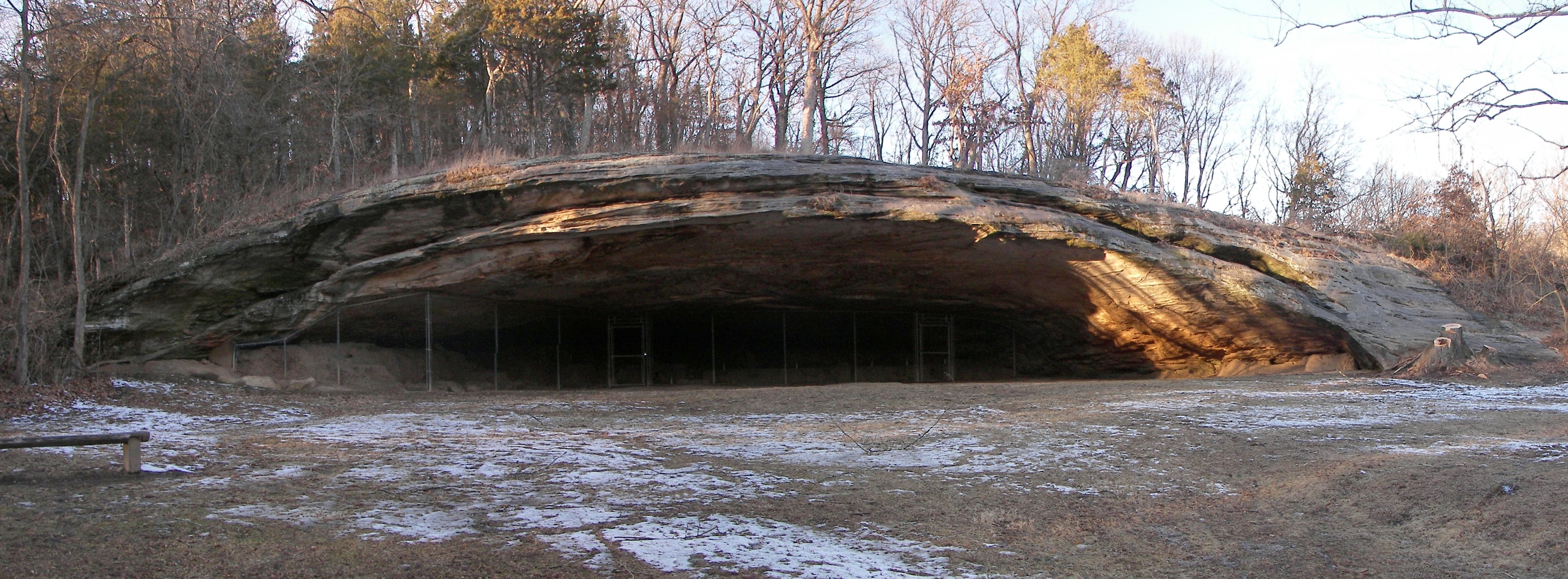
Graham Cave
Graham Cave State Park will host First Friday Hikes the first Friday of each month through October. Sponsored by Missouri State Parks, these naturalist guided walks through the unique landscape of the park will start at 9:30 a.m. and last two to three hours.

The hike will start at the covered picnic shelter in the lower parking area. The terrain will range from flat-bottomland to rocky and rugged hills, so sturdy shoes or boots are recommended. Bringing water and a snack is also encouraged.

Graham Cave State Park is located two miles off I-70 at 217 Highway TT in Danville. For more information about the event, call the park at 573-546-3476. For more information on state parks and historic sites, visit mostateparks.com. Missouri State Parks is a division of the Missouri Department of Natural Resources.

Sunday, June 7, 2015

Wildflower Walk at Prairie State Park

The public is invited to enjoy a wildflower walk on Saturday, June 13 at 10 a.m. at Prairie State Park’s Regal Tallgrass Prairie Nature Center.
Prairie State Park. Sponsored by Missouri State Parks, the hike will begin at

Participants will join a park naturalist for a walk among green grasses and colorful flowers to learn more about the prairie ecosystem. Dress for the weather and hiking across the prairie. Long pants, water, insect repellent, and sturdy shoes are recommended. The hike will last about two hours covering 1.5 - 2 miles.

Prairie State Park is located at 128 NW 150th Lane, Mindenmines, MO. Please contact Prairie State Park at 417-843-6711 to register and get additional information about this event. For information about state parks and historic sites, visit www.mostateparks.com

Thursday, May 28, 2015

Enjoy fun adventures on National Trails Day with Missouri State Parks June 6

English: A map of Missouri showing Katy Trail ...
English: A map of Missouri showing Katy Trail State Park, the longest extant rails-to-trails project in the US at 225 miles (362 km). This map is based on 2008 data from Missouri Department of Natural Resources, Division of State Parkshttp://www.msdis.missouri.edu/datasearch/metadata/utm/st_katy_trail_utm.xml (Photo credit: Wikipedia)
Missouri State Parks will sponsor family-friendly activities throughout the state in celebration of National Trails Day on Saturday, June 6.  Guided hikes and nature programs are among the fun special events taking place in state parks and historic sites.  The day also encourages visitors to head out for a trail adventure hiking, riding, paddling or bicycling in a state park or historic site.
American Hiking Society’s National Trails Day is the country’s largest celebration of trails. It is a nationwide event designed to promote and celebrate the importance of trails in the United States.
“Missouri has an outstanding system of trails that provide opportunities for Missourians of all ages and skill levels to have an outdoor adventure,” said Bill Bryan, director of Missouri State Parks.  “Spending time outdoors and connecting with nature is not only a fun way to spend your time, it’s also a great way to stay healthy and reduce stress.”
In 2013, Missouri was named the best trails state in the nation by American Trails, a national, nonprofit organization working on behalf of the nation’s hiking, biking and riding trails. In April, Gov. Nixon and First Lady Georganne Nixon launched the third year of the 100 Missouri Miles Challenge. The challenge encourages Missourians to complete “100 Missouri Miles” of physical activity by walking, running, biking, rolling, paddling or hiking throughout Missouri, including in Missouri’s state parks. To sign up for the 100 Missouri Miles Challenge and begin logging miles, or to continue an existing account, visit100MissouriMiles.com.
For more information on National Trails Day, visit americanhiking.org/national-trails-day. For more information on Missouri state parks and historic sites or to find events planned on June 6, go tomostateparks.com. Missouri State Parks is a division of the Missouri Department of Natural Resources.

Wednesday, May 27, 2015

Travel back in time and explore the Boone’s Lick Trail June 6

This building in St. Charles served as the fir...
This building in St. Charles served as the first state capitol building of Missouri. The legislature met on the second floor from 1821 to 1826 while the new capitol in Jefferson City was being built. (Photo credit: Wikipedia)
Participants are invited to step back to 1820 with First Missouri State Capitol State Historic Site and The Historic Daniel Boone Home and Heritage Center on June 6. Sponsored by Missouri State Parks, the event will allow travelers to experience what it was like to travel on one of America’s early “highways,” the Boone’s Lick Trail.

The journey begins at the First Missouri State Capitol where participants will learn about the role of the trail in westward migration, about the original travelers and see a 1820s dry goods and hardware store. This introduction will take place in the buildings where Missouri’s first legislators met to undertake the task of reorganizing Missouri’s territorial government into a progressive state system.

Instead of covered wagons, present day travelers will be transported through time via modern transportation and travel the first 20 miles of the original route. Location of significant sites, such as forts, taverns (inns), bridges and stagecoach stops will be discussed along the way. In locations where remnants of the original sites exist, the bus will stop and allow for a more in depth experience.

The tour will then leave the original route and travel to the historic Daniel Boone Home. Travelers will experience frontier life through period demonstrations, hands on activities and an early 1800s meal served in a “dog trot” cabin. There will also be a tour of the original Boone home.

The tour will take place from 9 a.m.-5 p.m. Cost for the trip is $75 and includes transportation, a “frontier meal”, a snack and program materials. Participants must register in advance by calling636-940-3322 or

Co-sponsors of the event include Historic Daniel Boone Home and Heritage Center, the City of Cottleville and Boone’s Lick Road Association.

First Missouri State Capitol State Historic Site is located at 200 South Main Street, St. Charles. For more information about state parks and historic sites, visit mostateparks.com. Missouri State Parks is a division of the Missouri Department of Natural Resources.

Wednesday, May 20, 2015

Wildflower Walk planned at Onondaga Cave State Park May 23

The "lily pad room" in Onondaga Cave...

A guided hike focusing on native wildflowers will be held on May 23 at Onondaga Cave State Park near Leasburg. Sponsored by Missouri State Parks, the “Weeds to Wildflower Walk” will be on the Blue Heron Trail and led by Lil Collins, a wildflower gardener, Master Naturalist and a member of the Onondaga Friends Association.

Although the trail is an easy one-half mile walk, it boasts some of the most diverse plant species in the park. Participants will learn all about native wildflowers and how they can incorporate them into their own native wildflower gardens. If time permits, the group may decide to hike up to the glade on the Oak Ridge Trail.

Participants should wear sturdy shoes and bring water and snacks.

Onondaga Cave State Park is located seven miles southeast of the Leasburg exit off of Interstate 44 on Highway H. For more information about the event, contact the park at 573-245-6576. For more information on state parks and historic sites, visit http://mostateparks.com/. Missouri State Parks is a division of the Missouri Department of Natural Resources.

10 Tips to Keep Your Outdoor Gear in Working Order and Well Organized

Camping Gear - It's expensive to buy, make it last. Maintaining and organizing your outdoor gear is crucial for ensuring it remains func...